
Agriculture Seen from Space: What Airbus Defence and Space Brings to Farmers, Insurers and Agri-Industrial Companies
- Agrilinkage

- Mar 4
- 13 min read
Satellite Imagery and Agriculture: What Airbus Defence and Space Does for Farmers, Insurers and the Agri-Food Industry
A conversation with Montaine Foch, Product Marketing Manager for Agriculture and Sustainability at Airbus Defence and Space, at the Salon International de l'Agriculture in Paris, 2026
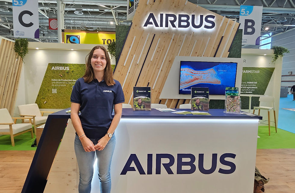
Nobody walks into an agricultural trade show expecting to find Airbus. The name conjures wide-body jets and departure terminals, not wheat fields or dairy farms. And yet here is Montaine Foch, entirely at home, standing in front of an Airbus stand surrounded by seed companies and livestock breeders. She trained as an agronomist engineer, and for the past two years she has been working at Airbus Defence and Space as Product Marketing Manager on agriculture and environment applications. Her job, as she describes it, is to explain something that remains genuinely unknown to most people: past the aircraft business, Airbus builds and operates a constellation of satellites that spend their time looking down at the Earth, its forests, its crops, its grasslands, with a precision and a consistency that no other technology can offer today.

This is not a PR exercise. It is a genuine act of translation. Taking what a team of engineers designed and put into orbit, and making it useful and understandable to a cattle farmer in central France or a head of procurement at a global food company.
The side of Airbus most people have never thought about
Airbus operates through several distinct divisions. Most people know the commercial aircraft division. There is also a helicopter business. And then there is Airbus Defence and Space, home to everything the group does in satellites and geospatial intelligence. That is where Montaine Foch works. The division runs a constellation of Earth observation satellites with full global coverage, offering imagery at resolutions down to 30 centimetres through its Pléiades Neo satellites, 50 centimetres through Pléiades, and 1.5 metres through SPOT. Defence, security and cartography have long been the primary users. Over the past several years, agriculture and environmental monitoring have become serious markets in their own right.

"We apply our images and the services derived from them to agriculture and the environment, which is why we are at the show today. Our clients include farmers, agricultural cooperatives, agricultural insurers, and agri-industrial companies committed to fighting deforestation."
Montaine Foch, Product Marketing Manager Agriculture and Sustainability, Airbus Defence and Space
One client type does not cover it. The range runs from an individual farmer managing a few hundred hectares to a multinational sourcing agricultural commodities from suppliers across multiple continents. Satellite data turns out to be genuinely relevant at every point along that chain, for very different reasons.
Farmstar: twenty-five years of fertilisation guided from space
The oldest of these services has a history that tends to surprise people. Farmstar has been running for twenty-five years. In an era when precision agriculture is often discussed as an emerging trend, Airbus has been giving French farmers satellite-based nitrogen fertilisation advice since the early 2000s.

Here is how it works. A farmer signs up through their cooperative or agricultural merchant, not directly through Airbus. They feed in a handful of details about their plot: the crop variety, soil type, sowing date, yield objective. Airbus images the plot from orbit and derives from those images what agronomists call biophysical parameters, specifically a reading of the plant's chlorophyll content and biomass at a given point in time. Those measurements are then run through agrometeorological models built by two French agricultural research institutes that co-develop the service with Airbus: Arvalis, which covers cereals, and Terres Inovia, which handles rapeseed.
The output is a recommendation. How much nitrogen can this crop absorb right now? Which zones of the plot need it most? Is this the right moment to apply, or should the farmer wait?
Farmstar, in essence, maps where a crop is hungry and where it is not. That map drives different decisions.

About 14,000 farmers currently use the service across France, across a combined area of roughly 600,000 hectares. Distribution runs through around thirty cooperatives and agricultural merchants, who pass it on to their members. Pricing sits between 3 and 15 euros per hectare per year, depending on the service tier and the distributor. The base offer covers nitrogen fertilisation advice. Higher tiers add a cover crop biomass estimation service that calculates how much nitrogen the soil has already received before the main cash crop goes in, so that the farmer does not over-apply on top of what is already there. Farmstar does not only manage what gets added. It accounts for what is already present.

"What I love most about this work is genuinely being able to combine my passion for the agricultural world, for the environment in general, and all the applications linked to digital technology and new technologies, with a company that is at the cutting edge and a leader in the field of satellite imagery."
Montaine Foch, Product Marketing Manager Agriculture and Sustainability, Airbus Defence and Space

The environmental benefit is a direct consequence of the economic one. Nitrogen that a crop cannot take up does not stay in the field. Rainfall pushes it down through the soil and into the water table. Applying less of it unnecessarily means less of it ends up where it should not be. Farmstar is sold on economics, not environmental credentials. But the two outcomes move together, and that is a big part of why the service has kept its users for twenty-five years.
The Grassland Production Index: rethinking agricultural drought insurance with satellite data
The second service Montaine Foch describes is less visible outside the farming world, but no less consequential for those who depend on it. The Grassland Production Index, or GPI, uses satellite data to measure grass growth across French permanent grassland on a continuous basis. What no ground-based monitoring network could ever achieve at this scale, the satellite does routinely.

The service works on a parametric basis. When satellite measurements show that grass growth in a given French commune has dropped below a defined threshold, compensation kicks in automatically for insured farmers. No claim to file, no loss assessor to wait for. The index is validated each year by an independent scientific committee whose conclusions are published under the authority of the French Ministry of Agriculture. It is the only satellite-based index in France that has received this formal recognition for grassland insurance.
Livestock farmers understand the problem this solves. Drought damage on grassland is slow, diffuse and nearly impossible to quantify farm by farm in a timely way. Conventional insurance has always struggled with it, leaning on individual expert visits that take time and cost money. A satellite index covering an entire commune with consistent, objective data changes that calculation entirely. For insurers, it provides a clean settlement basis. For farmers, it means compensation arriving when the grass has stopped growing, not months after the fact.

Insured farmers access the service through their agricultural insurer. Non-insured farmers can reach it through certain state subsidy schemes. One of the features of satellite data that Montaine Foch flags specifically is the depth of the historical archive: more than twenty years of grass growth data exists for any territory in France. For an insurer considering a new market, that means a complete risk history is available from day one, without having to wait years to accumulate it.
That is what positions this service as a natural candidate for international expansion, starting with other European countries, then anywhere that extensive grassland livestock farming faces meaningful drought exposure.
Starling: watching the world's tropical forests from orbit

The third service operates in a completely different world. Its clients are not farmers. They are procurement directors, sustainability leads and compliance teams inside large agri-food, cosmetics and chemical companies. The service is Starling, built jointly by Airbus Defence and Space and the NGO Earthworm Foundation, and it has been commercially available for around ten years.
Starling monitors deforestation across the supply chains of the commodities most closely linked to it: palm oil, cocoa, coffee, soya, rubber and timber. These are predominantly tropical crops, grown in regions where primary forest has historically given way to agriculture. The service combines two satellite data layers. The first produces monthly alerts flagging any change in forest cover, generated from Airbus imagery and freely available data from the European Copernicus programme, run through proprietary algorithms. The second is a Land Cover Map, a regularly updated classification of how land across every monitored territory is actually being used, distinguishing primary forest from plantations, natural areas from cropland, and so on. Between the two, a company can know in near real time whether any of its suppliers are operating somewhere they should not be.

The Airbus constellation is what makes the detail possible. At 30 centimetres resolution, Pléiades Neo can pick out individual trees. That level of granularity opens up things that coarser imagery cannot do: mapping cocoa and coffee crops inside complex forest landscapes, following agroforestry projects plot by plot, checking reforestation commitments over time. It is one of the finest commercial resolutions available for land observation anywhere in the world today.
"Ten years ago, we were starting with deforestation rates above 95%. Today, we are below 5%. These are very concrete impacts that companies achieve thanks to our data and our imagery."
Montaine Foch, Product Marketing Manager Agriculture and Sustainability, Airbus Defence and Space

Behind those numbers are clients like Nestlé and Ferrero, both of whom have been using Starling for roughly a decade. Montaine Foch makes a point of noting that neither company needed a regulation to push them into action. Both had zero-deforestation policies in place long before European law required it, and both used Starling data to go back to their suppliers, show them exactly what the satellite was seeing, and work with them on changing their practices.

The regulation eventually caught up. The EUDR, the European Union Deforestation-Free Regulation, now requires any company importing or exporting deforestation-risk commodities into or out of the EU to demonstrate that its supply chain is deforestation-free. Starling has been adapted to support that requirement. And the standards keep moving: the DCF framework, Deforestation and Conversion Free, takes things further still, extending the scope from forests alone to the full range of natural ecosystems, tropical savannahs, wetlands, native grasslands. The pace of regulatory change is fast. The data infrastructure is there.
What this actually changes
Montaine Foch does not speak like someone running through a product brief. She speaks like an agronomist who has spent time thinking about both ends of what she works on: what the satellite captures, and what that ultimately means for someone standing in a field.

"It is genuinely a source of pride to be able to combine these two passions and turn them into very concrete applications where end users really receive benefits and positive outcomes in their daily lives."
Montaine Foch, Product Marketing Manager Agriculture and Sustainability, Airbus Defence and Space
A livestock farmer staring at burnt-out pasture in August does not need to be told the drought is bad. What she needs is a fast, fair way to get compensated without spending half a year proving something she can see with her own eyes. For a cereal grower, the value of Farmstar is not the technology behind it. It is a clear answer to a question that comes up every season: how much nitrogen, exactly where, and is right now actually the right time. Getting that wrong in either direction costs money or costs the environment. For a procurement team at a confectionery company, Starling is not a sustainability communications tool. It is auditable, monthly evidence that the suppliers in their network are doing what they said they would.

Across all three services, what Airbus Defence and Space is really doing is converting the satellite's unbroken view of the planet into decisions that matter on the ground. The satellite keeps passing overhead, keeps recording, keeps comparing what it sees today with what was there last season and ten years before that. The value is not in any single image. It is in the depth of what has been built up over time.
Why this work matters
There is a question that rarely gets asked of people who have built careers inside large technology companies: why this, and why them. Montaine Foch answers it without being prompted, because the answer is woven through everything she talks about.

She is an agronomist engineer. A cooperative, a research institute, a government agency, all of these were options. She chose Airbus Defence and Space because it is the place where her two deepest interests, the agricultural world and space technology, are not just adjacent but genuinely integrated. And because what gets built there does not stay in a lab. It reaches 14,000 farmers. It sends compensation to livestock farmers when drought destroys their pasture. It has helped bring deforestation rates in some major supply chains from above 95% to below 5%.
"These are financial lifelines that allow them to keep their operations going, to keep living and feeding their animals. That is what I am passionate about."
Montaine Foch, Product Marketing Manager Agriculture and Sustainability, Airbus Defence and Space
Not technology as an end in itself. Technology as the thing that makes a specific difference, on a specific piece of land, for a specific person, somewhere in the world.
What agricultural professionals need to know
For cereal and livestock farmers, the three services here tackle different problems, but none of them abstract. Farmstar takes the guesswork out of nitrogen fertilisation, protecting yield and groundwater at the same time. The Grassland Production Index gives livestock farmers drought insurance that does not require them to navigate a claims process while their animals are running out of feed. Both services reach farmers through existing cooperatives and agricultural insurers, so the entry point is familiar, not a new technology adoption from scratch.

For institutional players, whether insurers, cooperatives, public bodies or agricultural finance organisations, the offer from Airbus Defence and Space is something that cannot be replicated from scratch: decades of satellite infrastructure, a historical archive of up to 25 years for grassland data, and indices validated by independent scientific bodies under the authority of the French state. The Grassland Production Index is not a research prototype. It is the only satellite-based index formally approved for grassland insurance in France. That matters for anyone building financial products or agricultural policy on top of it.
For agri-food, cosmetics and commodity trading companies facing EUDR obligations or voluntary deforestation commitments, Starling is one of the most complete tools on the market today for providing continuous, documented, satellite-verified proof of a deforestation-free supply chain. At 30 centimetres resolution, the monitoring is precise enough to work at the level of individual trees, not just broad forest blocks.
Airbus Defence and Space is active in the agriculture and environment markets through its services Farmstar, the Grassland Production Index and Starling.
Learn more at space-solutions.airbus.com
Frequently Asked Questions
Does Airbus work with agriculture? Yes. Through its Defence and Space division, Airbus has operated satellite-based agricultural services for over twenty-five years. These include Farmstar for precision nitrogen fertilisation, the Grassland Production Index for drought insurance on permanent grassland, and Starling for deforestation monitoring in agri-food supply chains.
What is Farmstar and how does it work? Farmstar is a precision agriculture service that uses satellite imagery to advise French farmers on nitrogen fertilisation. It extracts biophysical parameters including chlorophyll content and biomass from satellite images, feeds them into agrometeorological models developed by Arvalis and Terres Inovia, and delivers plot-level recommendations on when, where and how much fertiliser to apply. Around 14,000 farmers currently use it across approximately 600,000 hectares of French farmland.
What is the Grassland Production Index? The Grassland Production Index is a satellite-based measure of grass growth used in France for agricultural drought insurance. It works on a parametric model: if measured grass growth in a commune falls below a defined threshold due to drought, compensation is triggered automatically for insured farmers. It is the only satellite-based index formally validated for this purpose in France, under the authority of the French Ministry of Agriculture.
What is Starling by Airbus? Starling is a deforestation monitoring service co-developed by Airbus Defence and Space and the NGO Earthworm Foundation. It uses satellite imagery to detect monthly changes in forest cover and map land use across the supply chains of commodities including palm oil, cocoa, coffee, soya, rubber and timber. It supports companies in meeting voluntary no-deforestation commitments and legal requirements such as the European EUDR.
What is the EUDR and how does Starling support compliance? The European Union Deforestation-Free Regulation requires companies importing or exporting certain commodities into or out of the EU to prove their supply chain is deforestation-free. Starling provides the satellite-verified monitoring and documentation that companies need to meet this requirement, tracking forest cover changes at plot level across all relevant sourcing territories.
What satellite resolution does Airbus use for agricultural and environmental monitoring? The Airbus Defence and Space constellation includes Pléiades Neo at 30 centimetres resolution, Pléiades at 50 centimetres, and SPOT at 1.5 metres. The right resolution depends on the application, ranging from broad land cover monitoring to individual tree identification in cocoa and coffee supply chains.
Can satellite data be used for crop insurance? Yes. The Grassland Production Index is a fully operational example of satellite data used for parametric crop insurance at scale. It covers permanent grassland across France with up to 25 years of historical archive, enabling automatic compensation without individual farm assessments.


Comments